LT
Tuesday, July 24, 2012
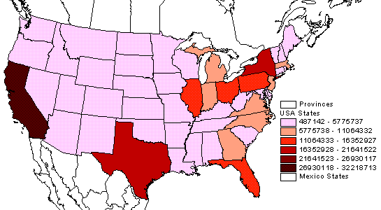
Choropleth maps
http://hosting.soonet.ca/eliris/remotesensing/LectureImages/statespopmap.gif
A choropleth map is a map with areas of it shaded to refrence a certain statistic. The map above shows the population of different states by color.
No comments:
Post a Comment
Newer Post
Older Post
Home
Subscribe to:
Post Comments (Atom)

No comments:
Post a Comment